Unlocking Spatial Insight, Empowering Progress …
Our Services
REMOTE SENSING AND INFORMATION PRODCUTS
With satellite imagery and aerial photography, we offer remote sensing services to monitor environmental changes, assess natural resources
GEOGRAPHIC INFORMATION SYSTEMS (GIS) APPLICATION DEVELOPMENT
We design and implement custom GIS solutions tailored to the specific needs of our clients, providing intuitive tools for data collection, analysis, and visualization.
SPATIAL MODELLING AND SIMULATION
Using advanced modeling techniques, we simulate real-world scenarios to predict outcomes and inform strategic decision-making in areas such as disaster management

Who we are
At Spatial Dynamics (SDL), we are more than just a geospatial company. We are pioneers in the field utilizing advanced geospatial technologies to provide actionable insights that drive informed decision-making and empower businesses and organizations to thrive in an increasingly complex world.
Our service includes Remote Sensing and Information Products, GIS Application Development and Solutions, Spatial Data and Business Analytics, Spatial Modeling and Stimulations, System Engineering and Security Architecting, Geospatial Training, Mapping and Cartography, Smart Agric and M&E, Drone and UAV Services, Sale of GNSS Hardware and Geospatial Software.
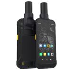
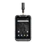
Product Categories
Our Products


Many Major Companies Trust Us
The are some brands we work with